Press kit
Everything a reporter needs to check before covering SafeWalkr: a copy-pasteable boilerplate, citable findings with sources, downloadable charts and logos, and a direct line to the team.
Boilerplate
SafeWalkr finds the safest walking route to school for Fairfax County Public Schools families — not just the shortest one. Every route is built from the county’s sidewalk inventory, 2024 traffic counts and FCPS crossing-guard posts, layered onto OpenStreetMap’s map of streets and paths, and weighed against what a child’s walk actually costs: time spent in the roadway of a busy road, the number of crossings, whether a guard is posted. It covers all 188 FCPS attendance zones, is free to use, and is available in English and Spanish. SafeWalkr is an independent project; it is not affiliated with, endorsed by, or operated by Fairfax County Public Schools or Fairfax County government.
Key findings
-
For roughly two homes in three, the safest walk to school is not the shortest one — and for a typical home, the safer route takes only 25 seconds longer.
Source: “The price of the safest walk” -
SafeWalkr has routed and measured all 9,731 homes across its 14 walk zones, totalling 9,614 km of walking.
Source: “Walking to school, by the numbers” -
Sidewalk coverage on the safest route ranges from 46.1% of the walk (Chesterbrook ES) to 99.9% (Cardinal Forest ES) across the 14 measured zones; district-wide, 93.5% of all safest-route walking distance is on a sidewalk.
Source: “Walking to school, by the numbers”
Downloadable charts and maps
Full resolution, direct links. Right-click or use the browser’s save-image option to download.
-
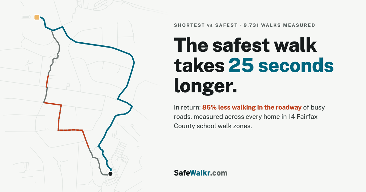
Two routes from the same home: shortest through a no-sidewalk stretch, safest around it.
-
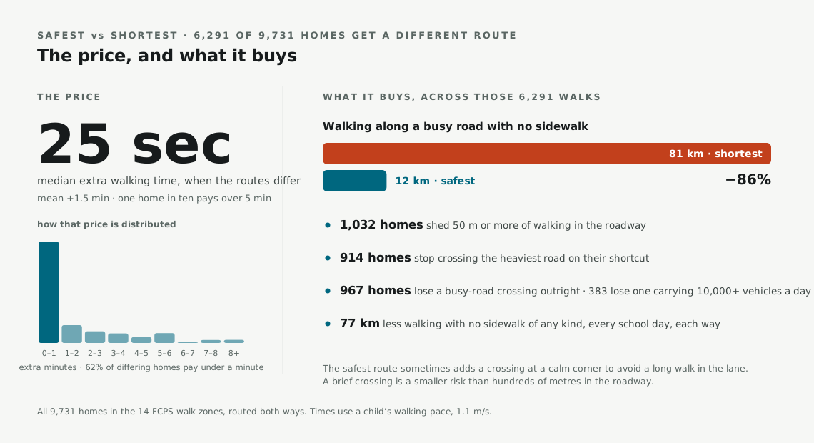
The price (extra seconds) and what it buys (roadway walking avoided), district-wide.
-
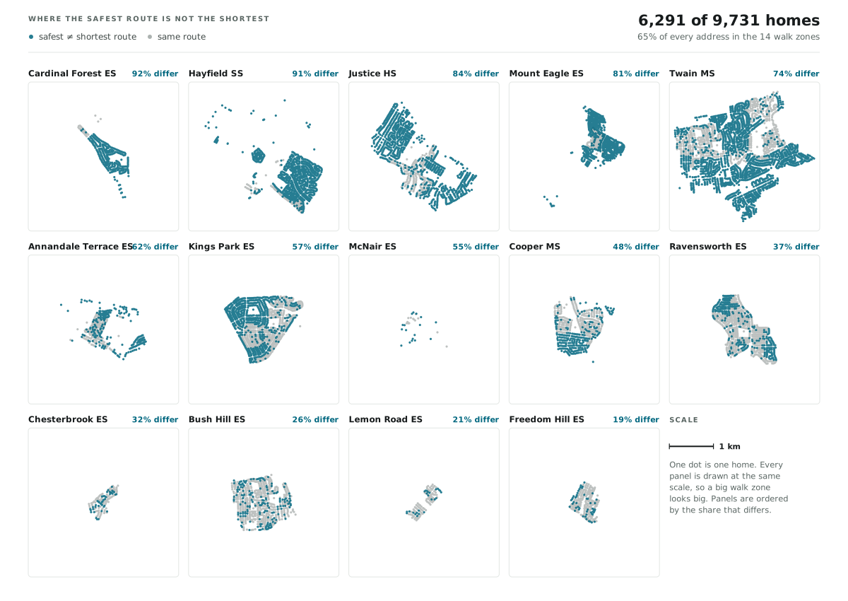
All 14 walk zones, every home dotted by whether the safest route changes.
-
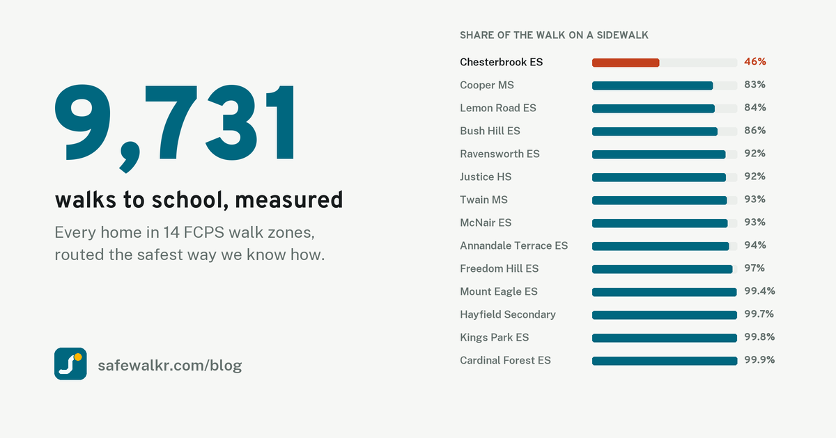
Sidewalk coverage ranked across all 14 walk zones, from 46.1% to 99.9%.
-
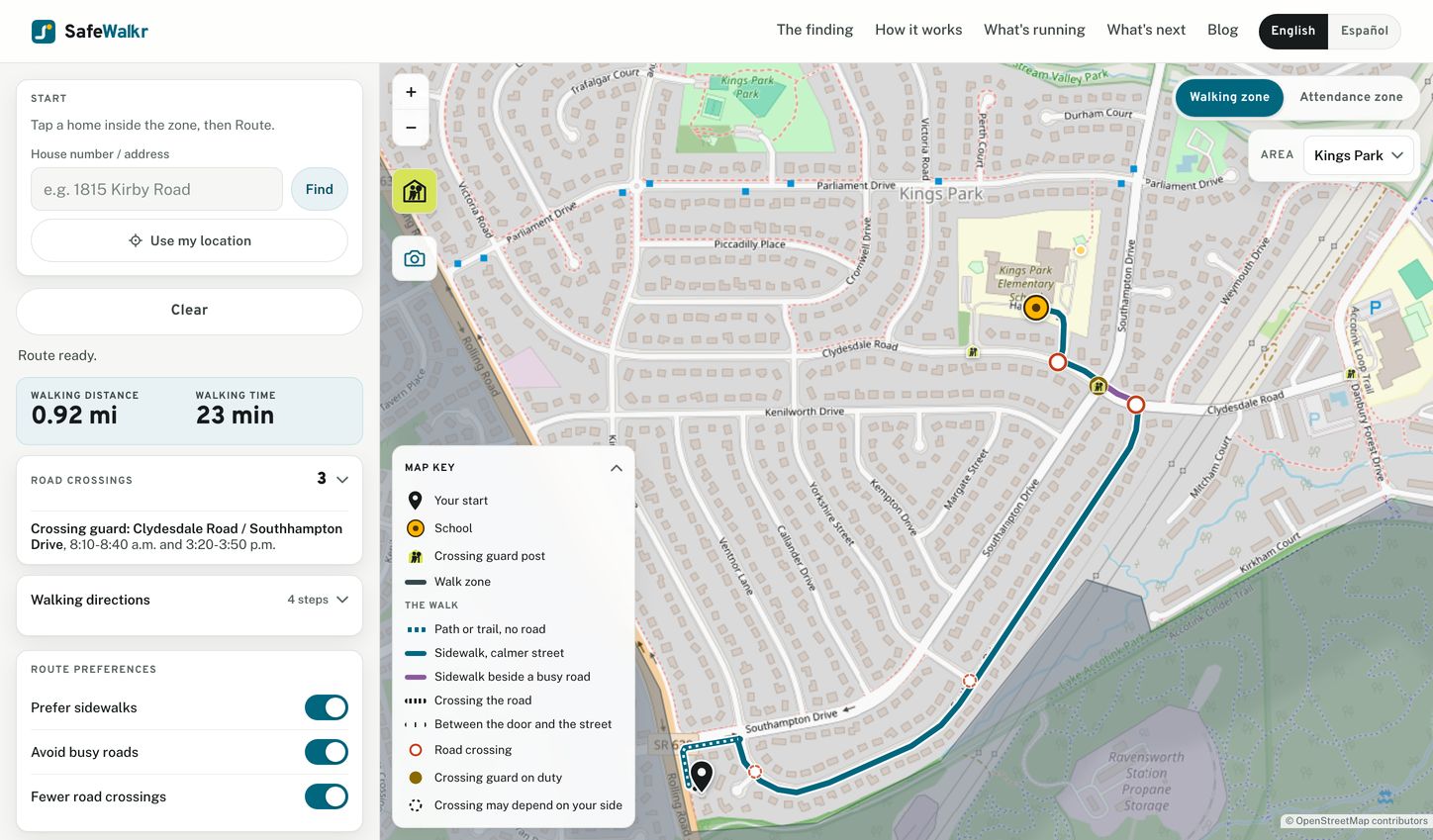
The SafeWalkr app: a real route to Kings Park Elementary, with crossings and a guard post marked.





Logo




Facts at a glance
| Coverage | Every FCPS attendance zone: 188 zones, 138 elementary, 26 middle, 24 high |
|---|---|
| Data sources | Fairfax County sidewalk inventory, 2024 county traffic counts, FCPS crossing-guard posts, OpenStreetMap |
| Price | Free |
| Languages | English and Spanish |
| Status | Independent project. Not affiliated with, endorsed by, or operated by Fairfax County Public Schools or Fairfax County government. |
Contact
info@safewalkr.comInterviews and custom data cuts for stories are available on request.
Usage note
Charts and screenshots on this page may be republished with credit and a link to safewalkr.com.